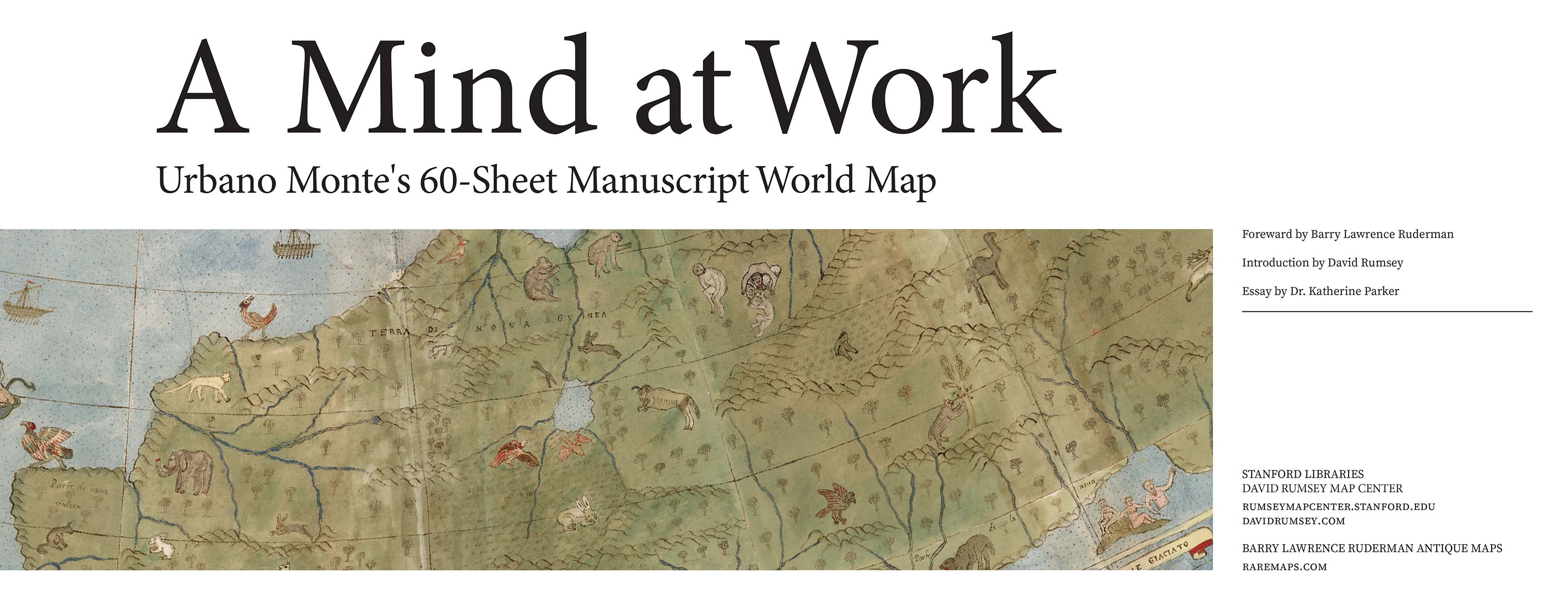
Une ancienne carte unique représentant la Terre vue de l’espace
restaurée numériquement
image:
https://www.anguillesousroche.com/wp-content/uploads/2017/12/map-monte.jpg
·
TWEET
·
SHARE
·
+1
En 1587, Urbano Monte (1544-1613), un
cartographe méconnu, a créé une étonnante carte dessinée à la main de 3 mètres
sur 3 mètres.
Non seulement la carte dépeint la Terre vue de l’espace, en
regardant directement vers le pôle Nord, mais elle est aussi remplie d’images
incroyables de lieux étrangers et de créatures mythologiques étonnantes, comme
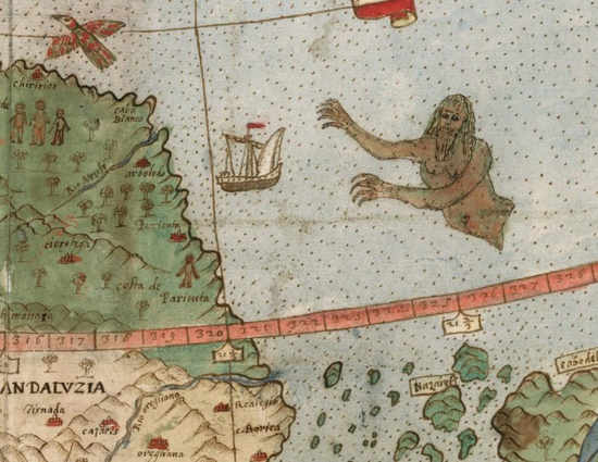
par exemple des licornes de Sibérie, des hommes attaquant les navires et des
oiseaux géants terrifiants.
image:
https://www.anguillesousroche.com/wp-content/uploads/2017/12/montesmap2.jpg
Crédit : David Rumsey
Les créatures mythologiques étonnantes ont toujours fasciné les
gens et nous avons maintenant la chance de les voir à travers les yeux de nos
ancêtres.
Cet atlas du monde unique a été restauré et assemblé
numériquement. Le cartographe Monte, qui s’intéressait beaucoup à la
géographie, venait d’une famille aisée de Milan, en Italie.
En 1585, il a rencontré une délégation japonaise et les
scientifiques pensent que la carte qu’il a créée est le résultat de sa
rencontre et des histoires qu’il a entendu parler au sujet du Japon. L’atlas
mondial contient de nombreux noms au Japon, qui n’apparaissent pas sur les
autres cartes occidentales créées à l’époque.
image:
https://www.anguillesousroche.com/wp-content/uploads/2017/12/montesmap3.jpg
Crédit : David Rumsey
Le collectionneur David Rumsey a acheté l’atlas antique et en a
fait don au David Rumsey Map Center de l’université Stanford, qu’il a fondé en
2016.
image:
https://www.anguillesousroche.com/wp-content/uploads/2017/12/montesmap5.jpg
Crédit : David Rumsey
La carte de Monte n’a jamais été correctement étudiée parce
qu’elle est cachée depuis des siècles.
Monte a créé sa carte 18 ans après Gérard Mercator, le
cartographe le plus connu de tous les temps a créé la carte qui est utilisée
aujourd’hui dans la plupart des salles de classe et les applications
smartphone.
image:
https://www.anguillesousroche.com/wp-content/uploads/2017/12/montesmap4.jpg
Crédit : David Rumsey
La grande contribution de Mercator à la cartographie réside dans
le fait qu’il a changé sa nature à l’aide de ses perfectionnements artistiques et
modifié à jamais la navigation océanique avec sa méthode de projection, qui a
été l’invention la plus influente de la première cartographie.
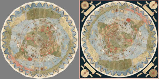
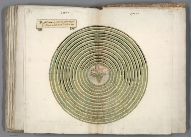
D’autre part Monte voulait montrer la nature circulaire de la
Terre. Selon Rumsey, le travail de Monte est beaucoup plus qu’une simple carte.
C’est tout un instrument scientifique.
La carte de Monte a été restaurée numériquement et vous pouvez
voir toutes les fiches individuelles ici.
Read more at
https://www.anguillesousroche.com/histoire/ancienne-carte-unique-representant-terre-vue-de-lespace-restauree-numeriquement/#1L04FqAlJT75sV2W.99
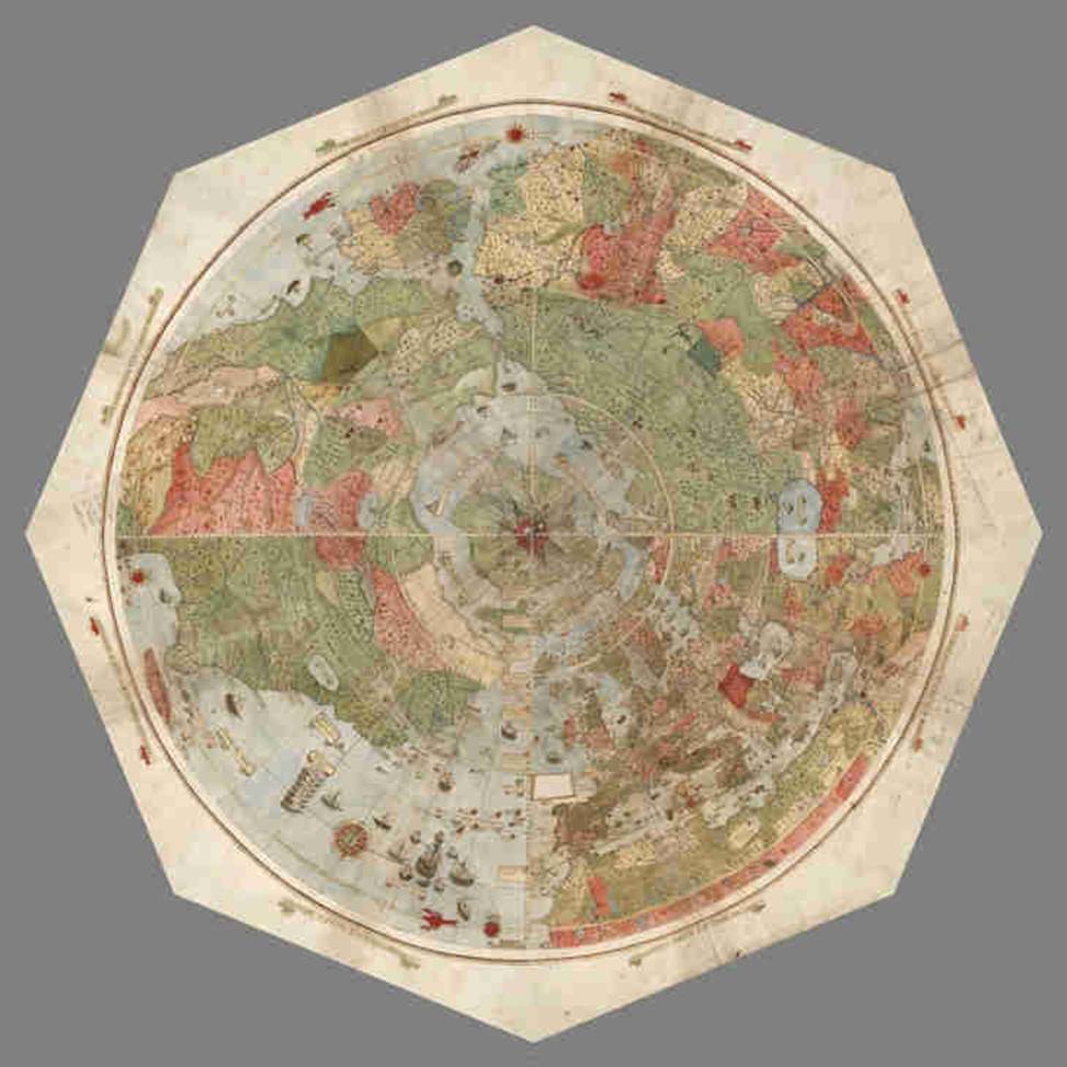
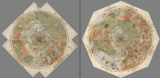
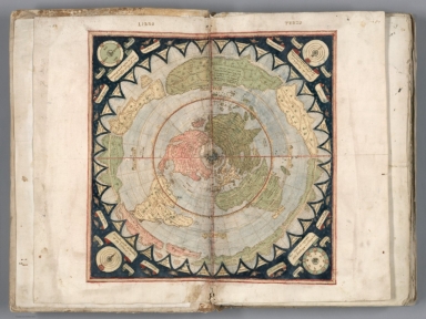
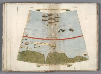
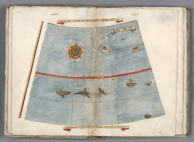
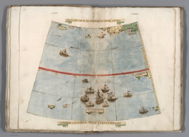
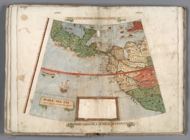
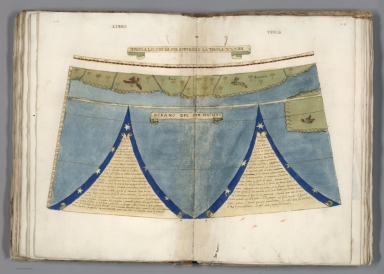
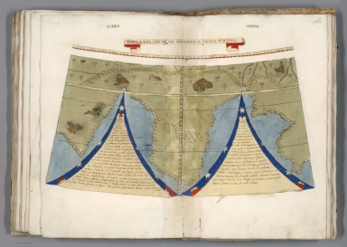
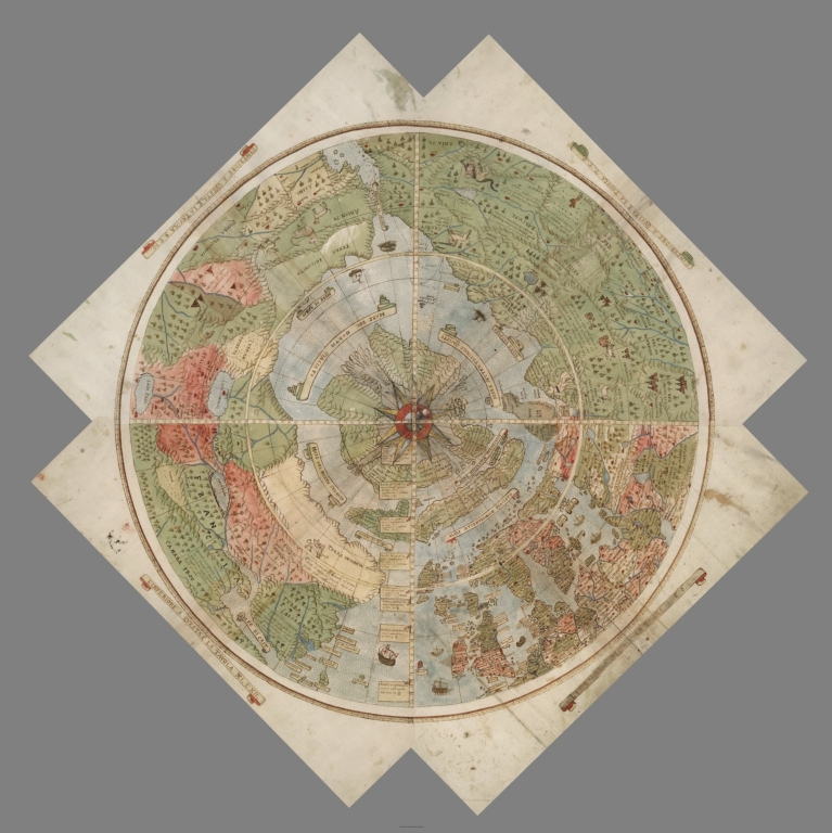
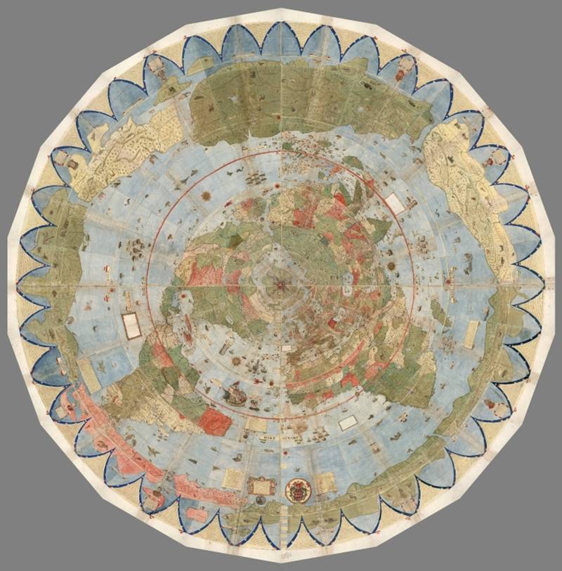
Largest Early World Map - Monte's 10 ft. Planisphere
of 1587
An extraordinary 60 sheet manuscript world map made in 1587 by
Urbano Monte has been added to the David Rumsey Map Collection at Stanford
University. At 10 foot square, this map or planisphere is the largest known
early map of the world. It was hand drawn by Monte in Milan, Italy, and only
one other manuscript copy exists. The digitally joined 60 sheet map image below
is the first time the map Monte made has been seen as one unified map - as
Monte intended - in the 430 years since it was created. See all the individual
sheets here.
Monte's map reminds us of why historical maps are so
important as primary resources: the north polar azimuthal projection of his
planisphere uses the advanced scientific ideas of his time; the artistry in
drawing and decorating the map embodies design at the highest level; and the
view of the world then gives us a deep historical resource with the listing of
places, the shape of spaces, and the commentary interwoven into the map.
Science, art, and history all in one document. Until now, Monte’s manuscript
map was seen as a series of 60 individual sheets. The only assembled version is
the small single page key sheet of the series.
Now that we have joined all 60 sheets digitally (accomplished with great skill
by Brandon Rumsey), we can appreciate in a new way the extraordinary
accomplishment that Monte made. The assembled map, just over 10 feet in
diameter, is one of the largest—if not the largest—world maps made in the 16th
century. The degree of detail and decoration is stunning and the entire
production is surely unique in the history of cartographic representation.
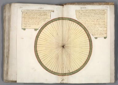
Monte made his map to serve not only as a geographical
tool but also to show climate, customs, length of day, distances within regions
- in other words, to create a universal scientific planisphere. In his
dedication on Tavola XL he specifies how to arrange the sheets of the
planisphere and makes it explicit that the whole map was to be stuck on a
wooden panel 5 and a half brachia square (about ten feet) so that it could be
revolved around a central pivot or pin through the north pole. This was never
done, but now we can do it virtually - Monte's 60 sheet world map
digitally assembled into a 10 foot planisphere:
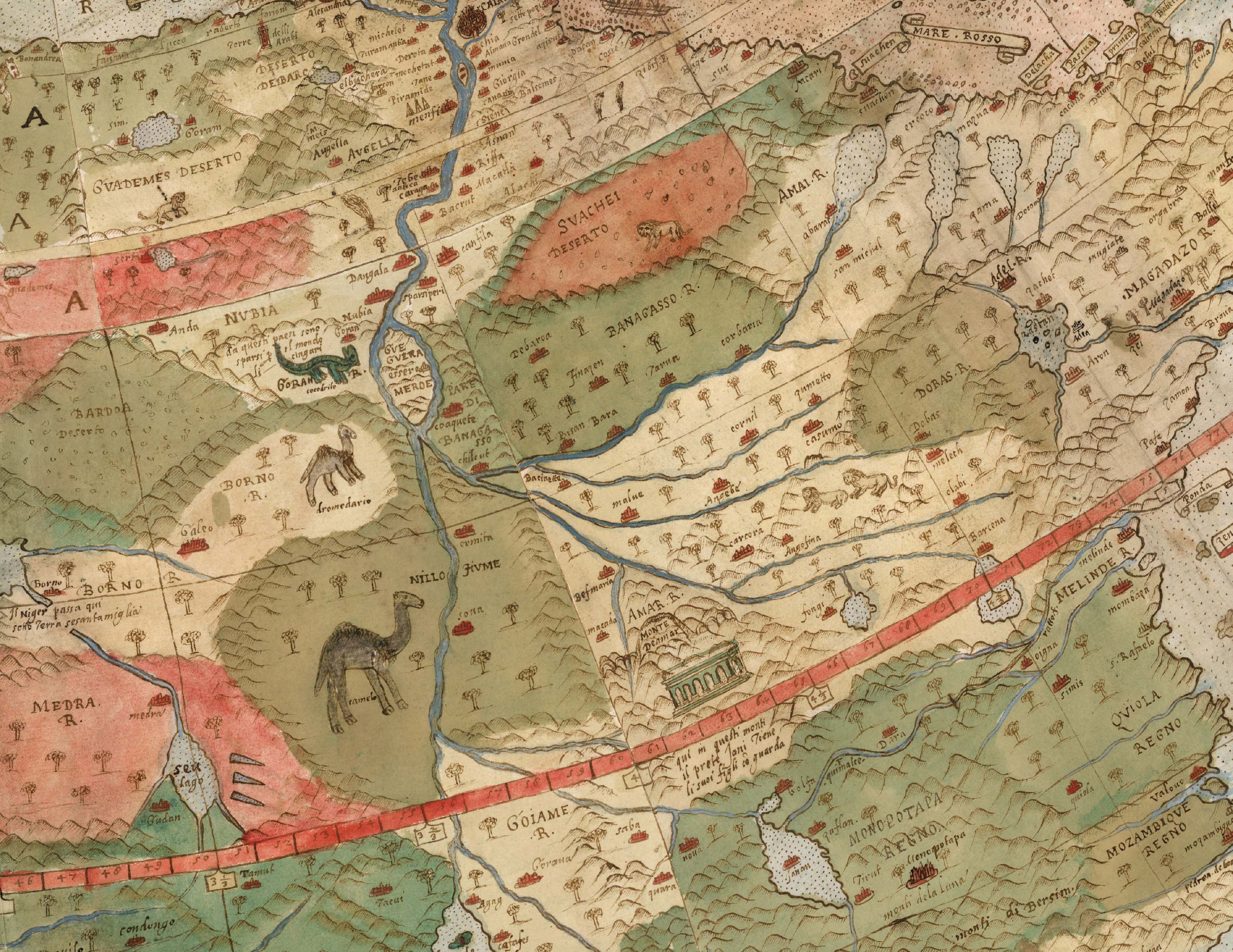
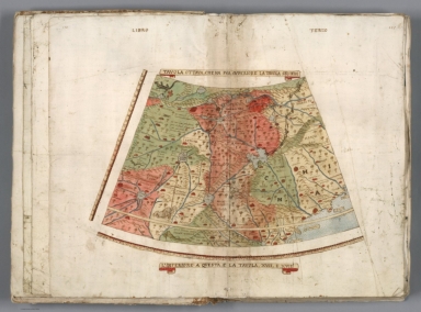
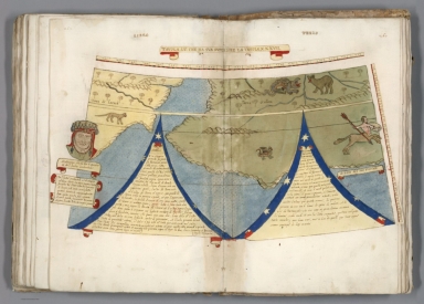
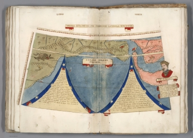
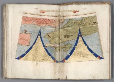
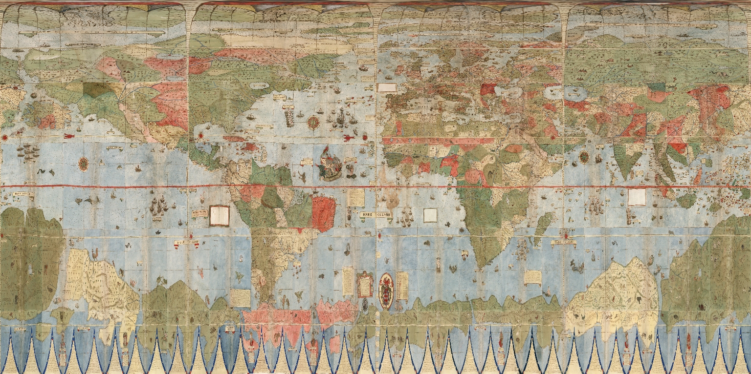
Detail of Tavola XIIII and Tavola XV
Joined (Central Africa)
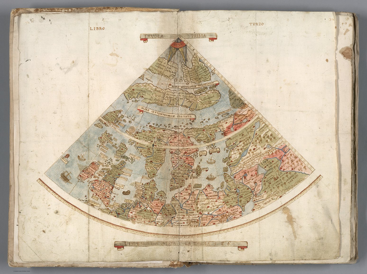
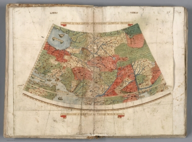
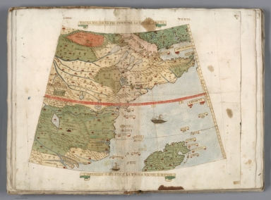
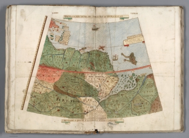
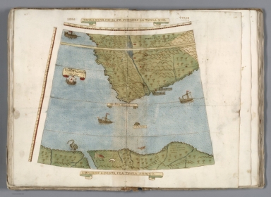
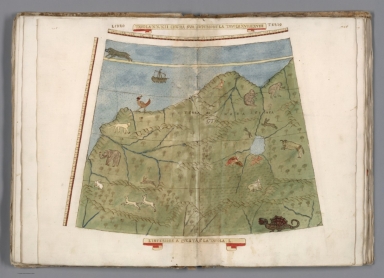
Tavola Prima (Northern Europe)
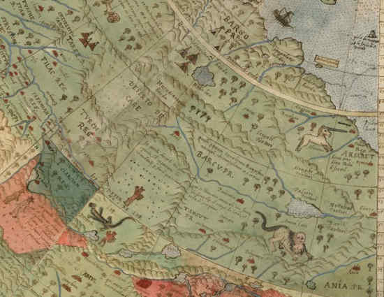
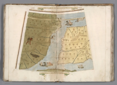
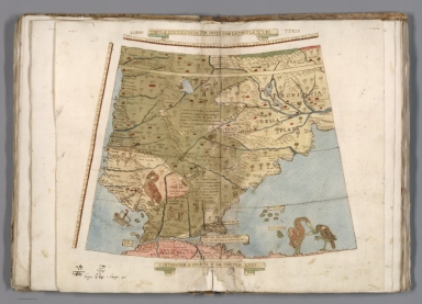
Monte's depiction of Japan is advanced for the time, probably drawing on
information provided to him by the Japanese Embassy to Milan and Italy in 1585.
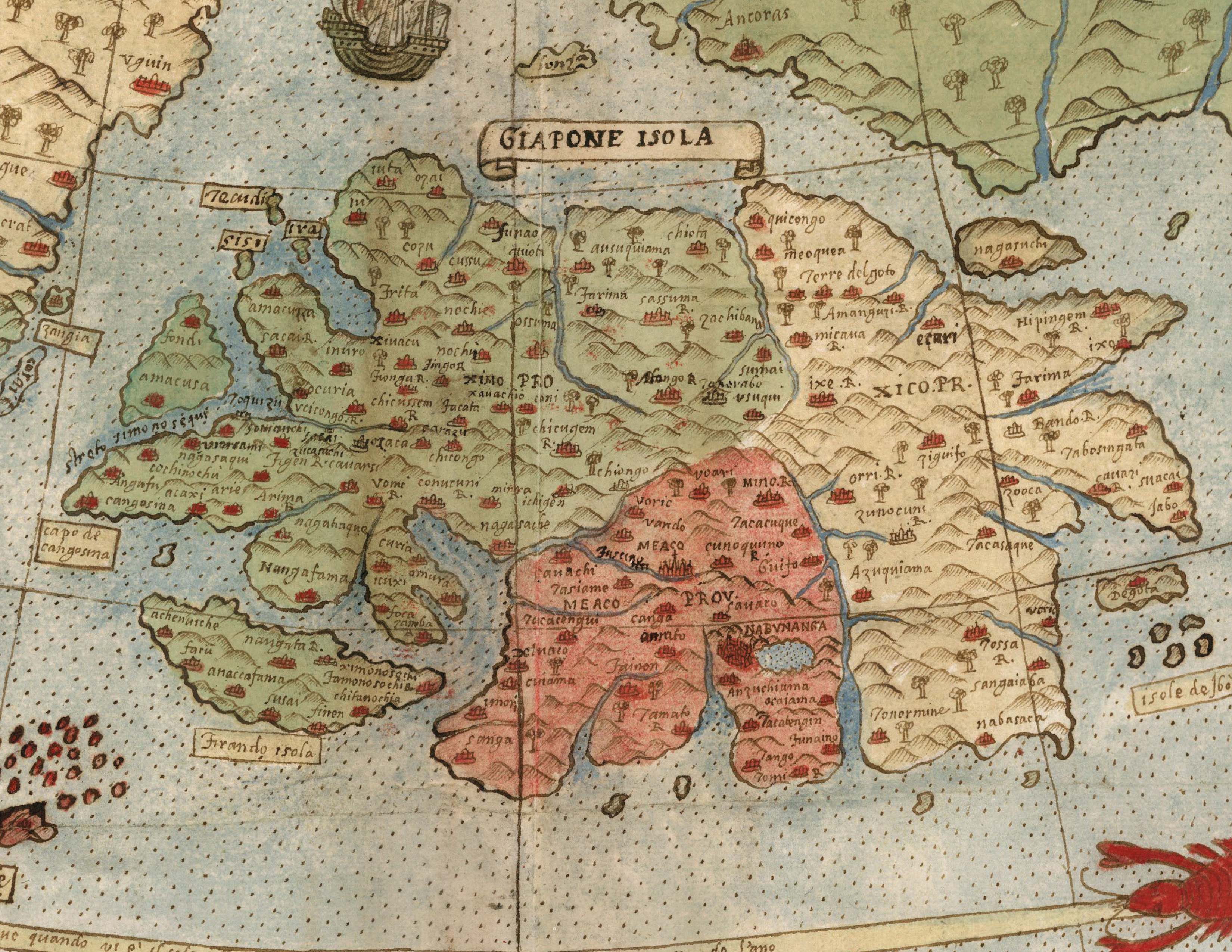
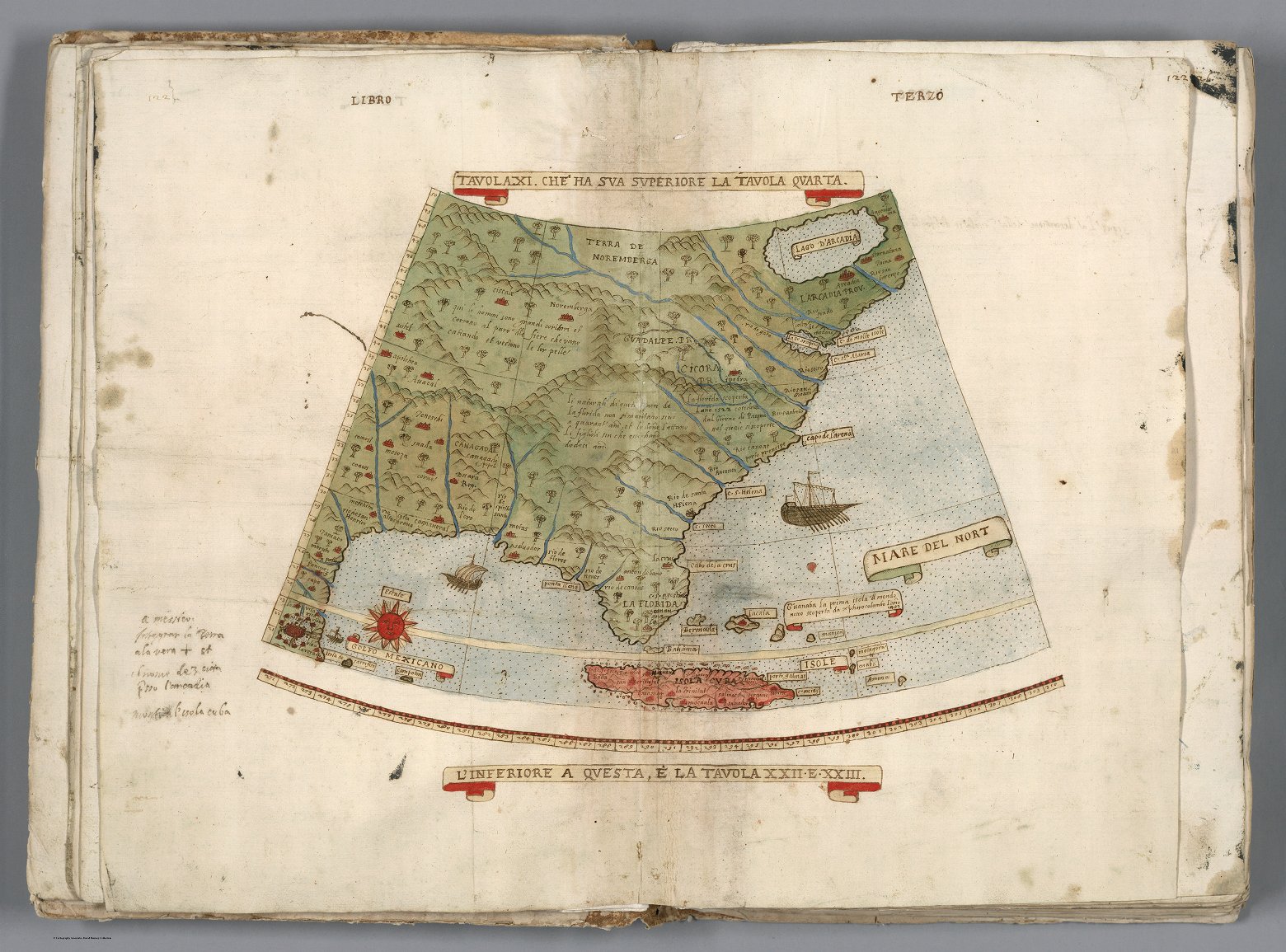
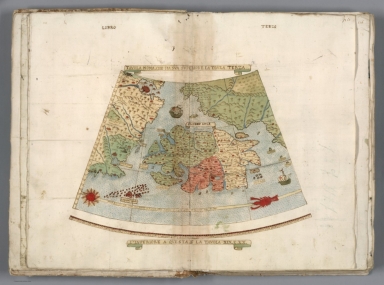
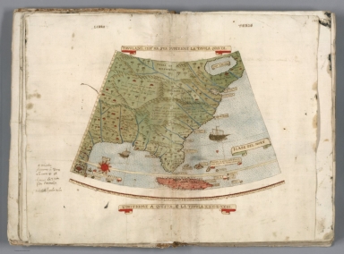
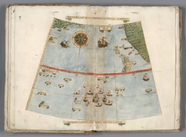
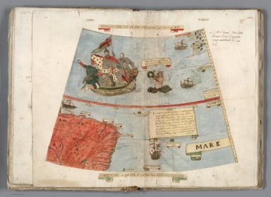
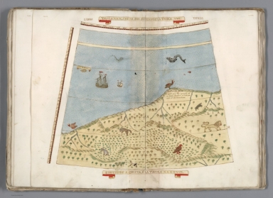
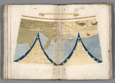
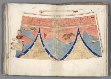
Tavola XI (Eastern United States,
Florida, Cuba)
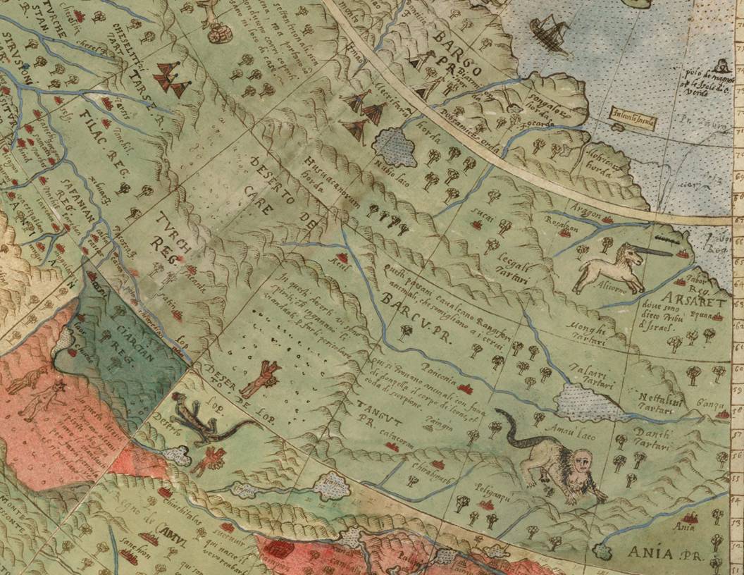
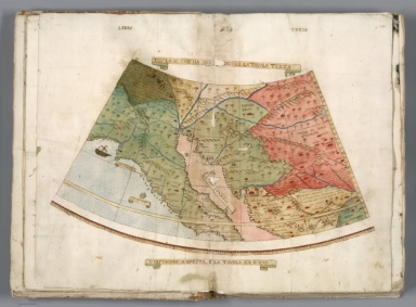
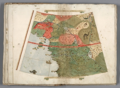
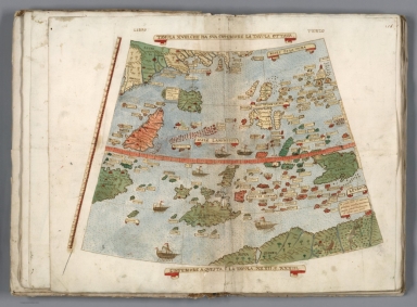
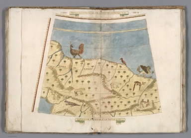
Details of Tavola Seconda, Tavola Ottava, and Tavola Setima
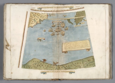
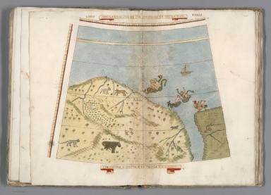
(Northern Siberia, Central Asia)

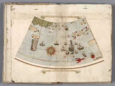
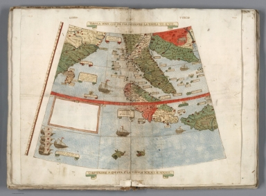
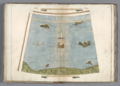
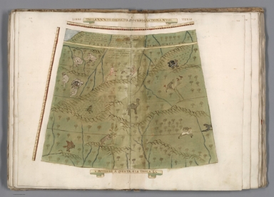
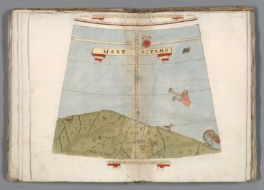
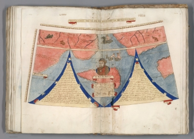
Tavola XXXX (Southern Argentina,
Southern Chile)
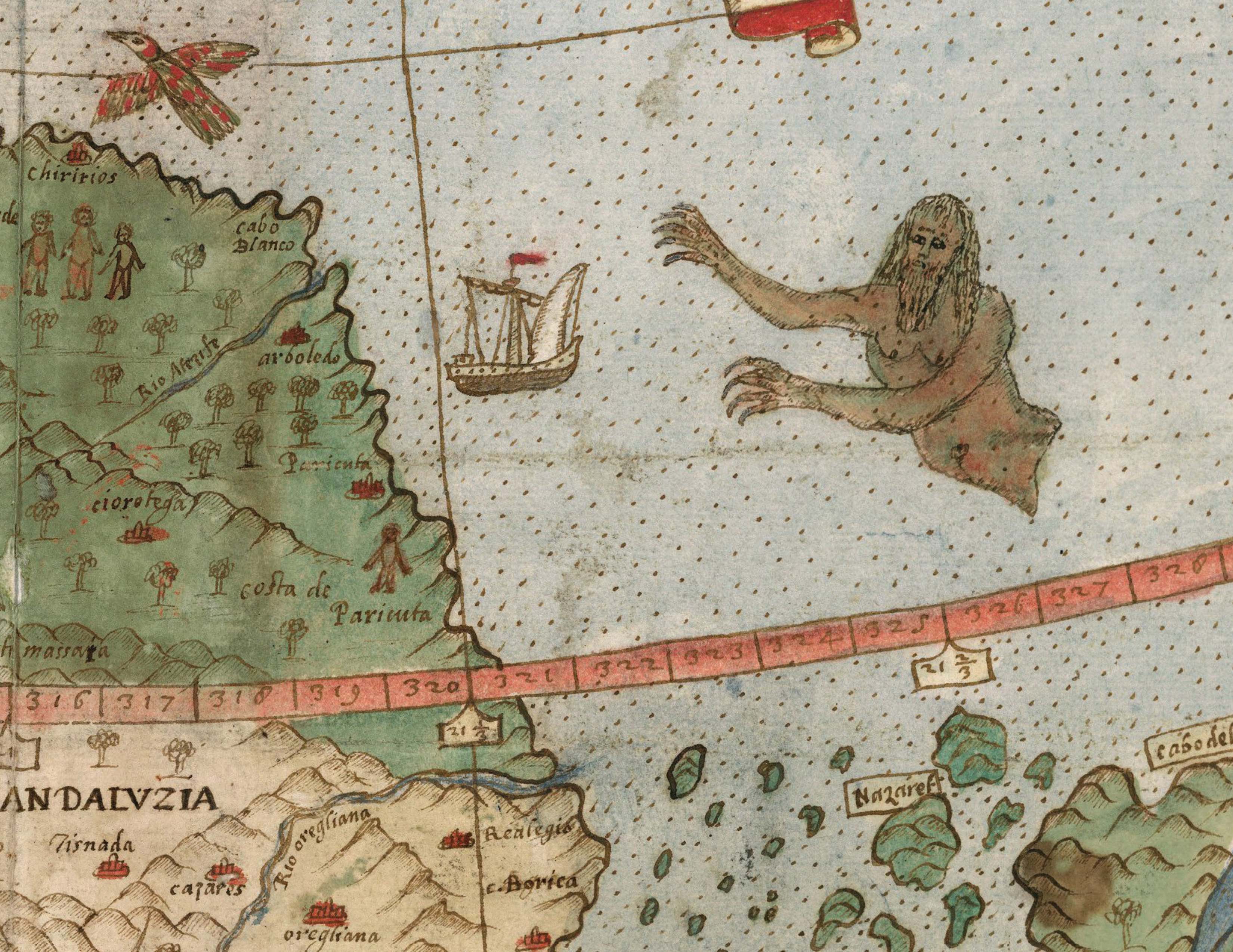
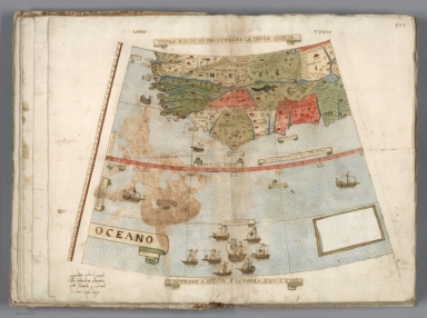
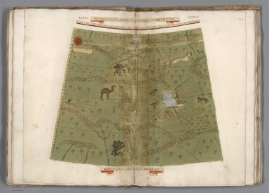
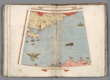
Detail of Tavola XXIII (South America, Venezuela, Guyana)
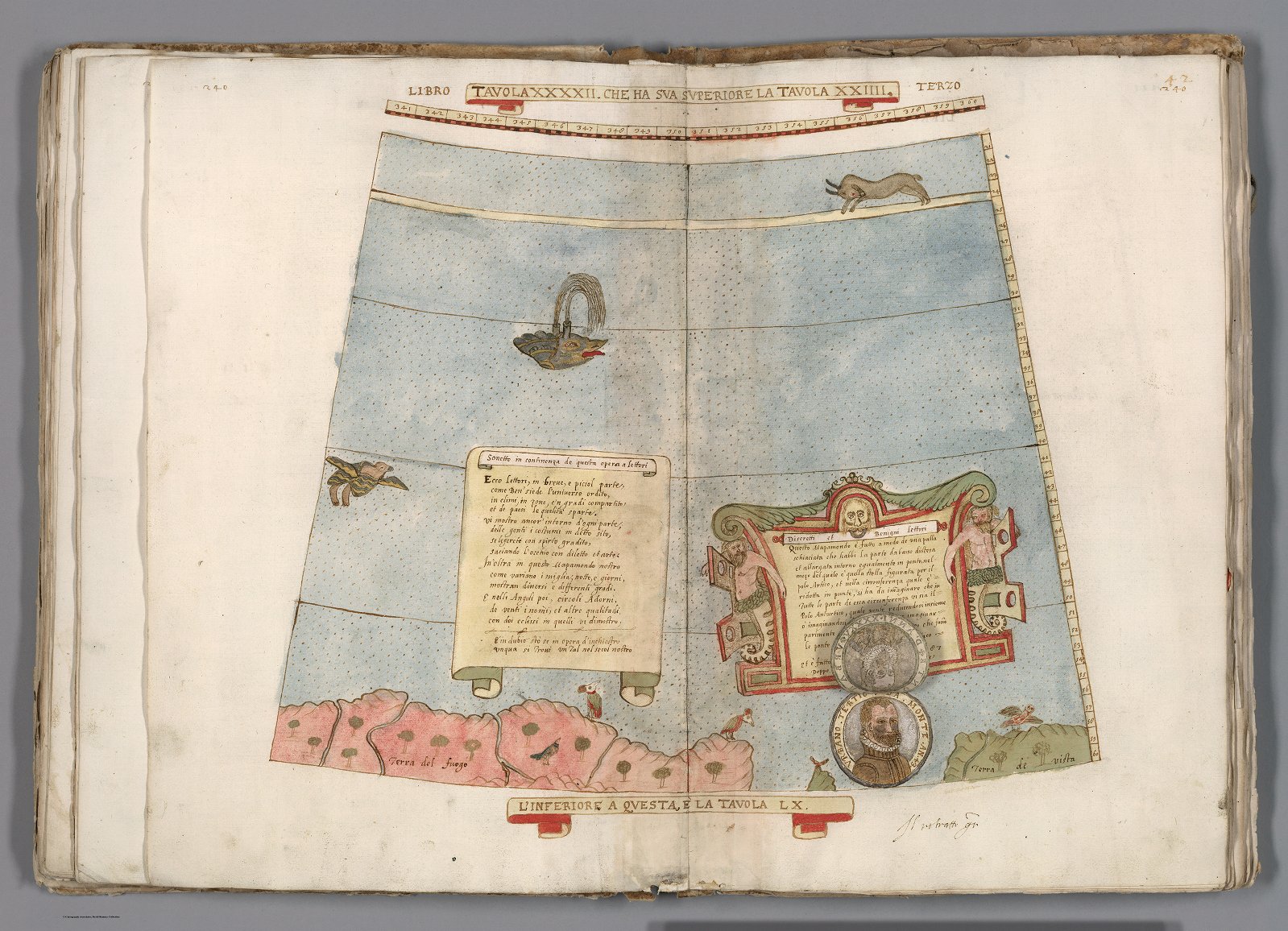
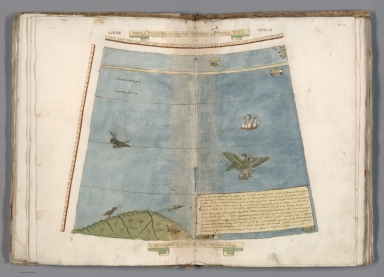
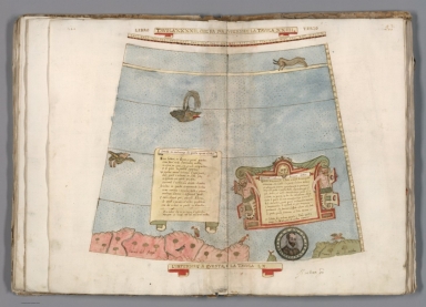
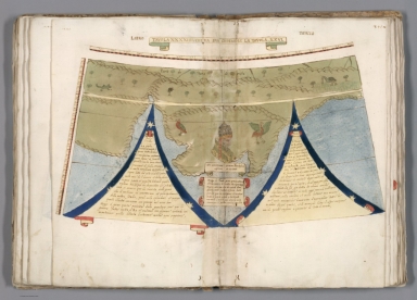
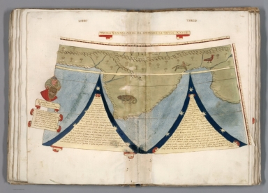
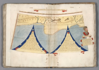
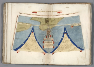
Tavola XXXXII (Antarctica, Map Dedication, Urbano Monte Portrait)
In 1589, two years after the map was completed but
perhaps still being revised, Monte updated his portrait at age 43 with a new
circular image pasted on top of the earlier one, now showing his age to be 45.
The new portrait is hinged and can be lifted up as illustrated below.
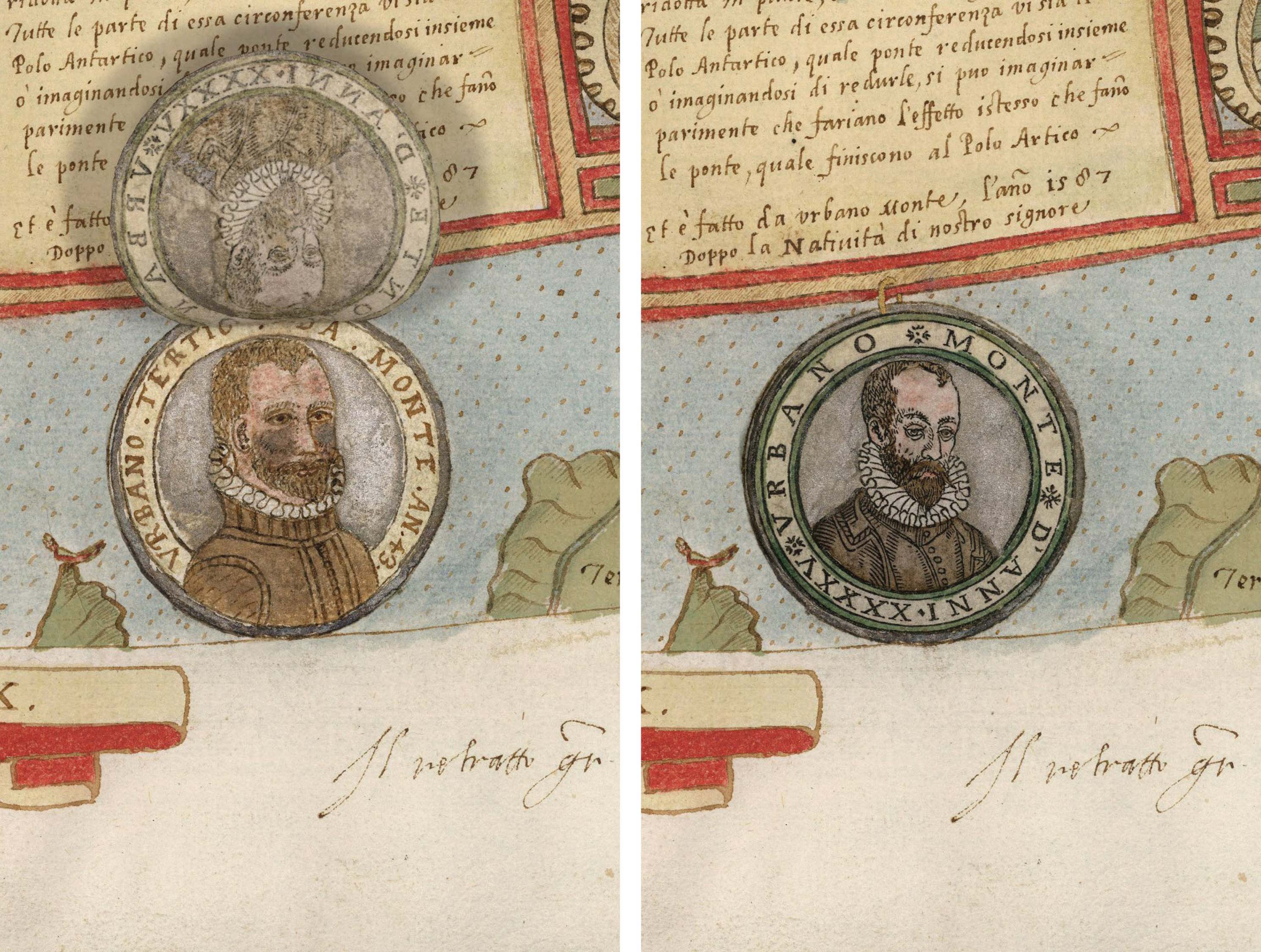
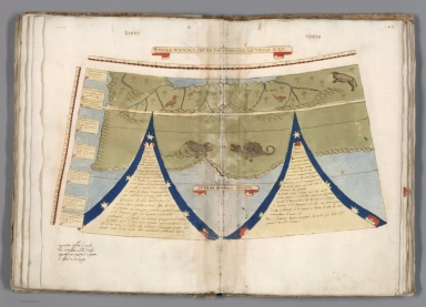
Detail of Tavola XXXXII (Antarctica,
Urbano Monte Portraits of 1587 and 1589)
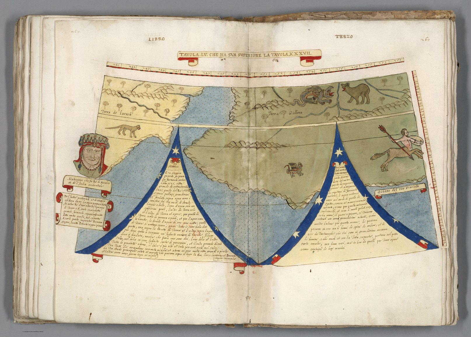
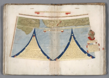
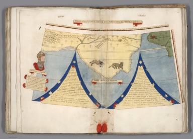
Tavola LV (Antarctica, Portrait of Montezuma)
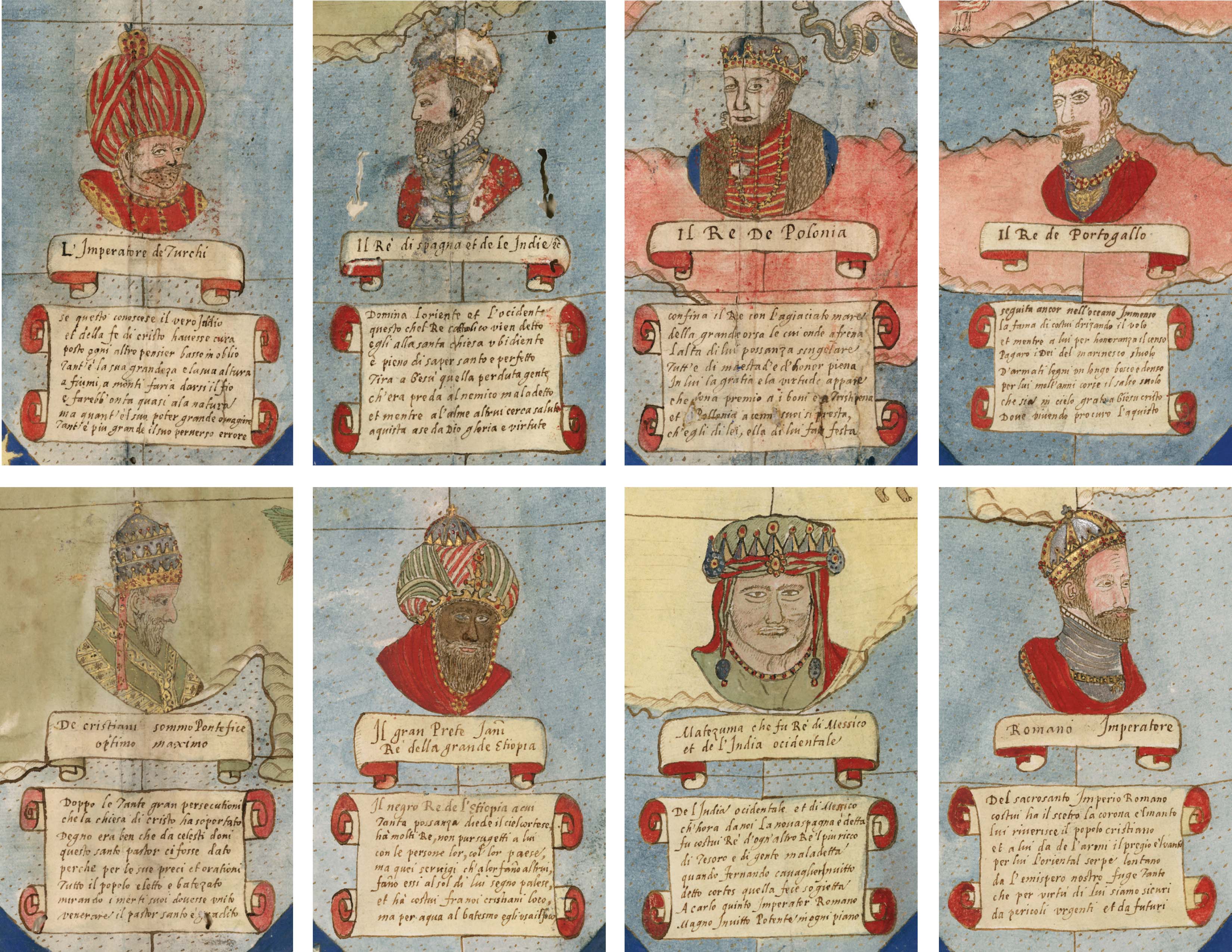
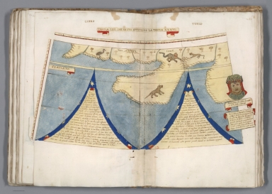
Details of Portraits from 12 Tavolas
Detail of Tavola XXIIII (Coast of
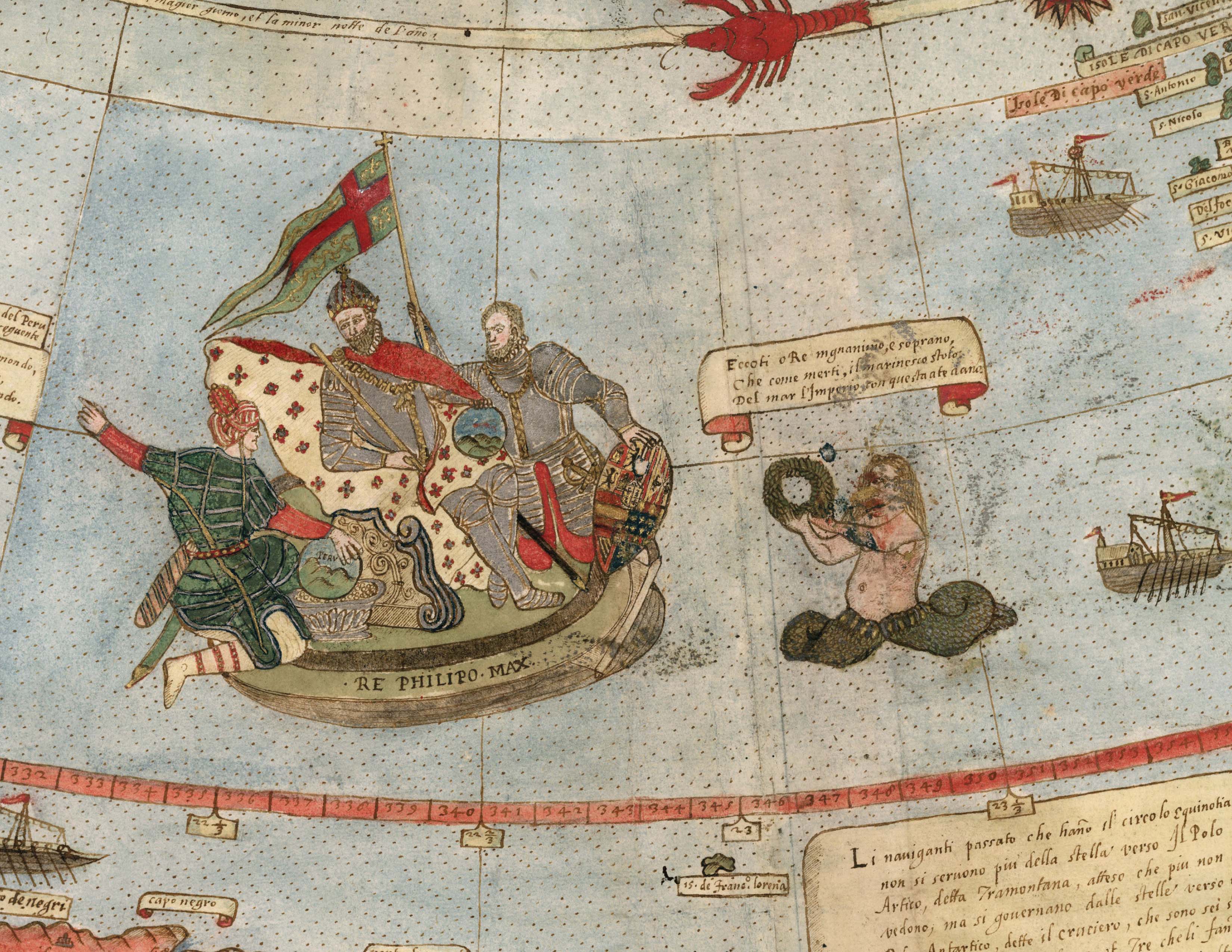
Brazil, Portrait of King Philip II of Spain)
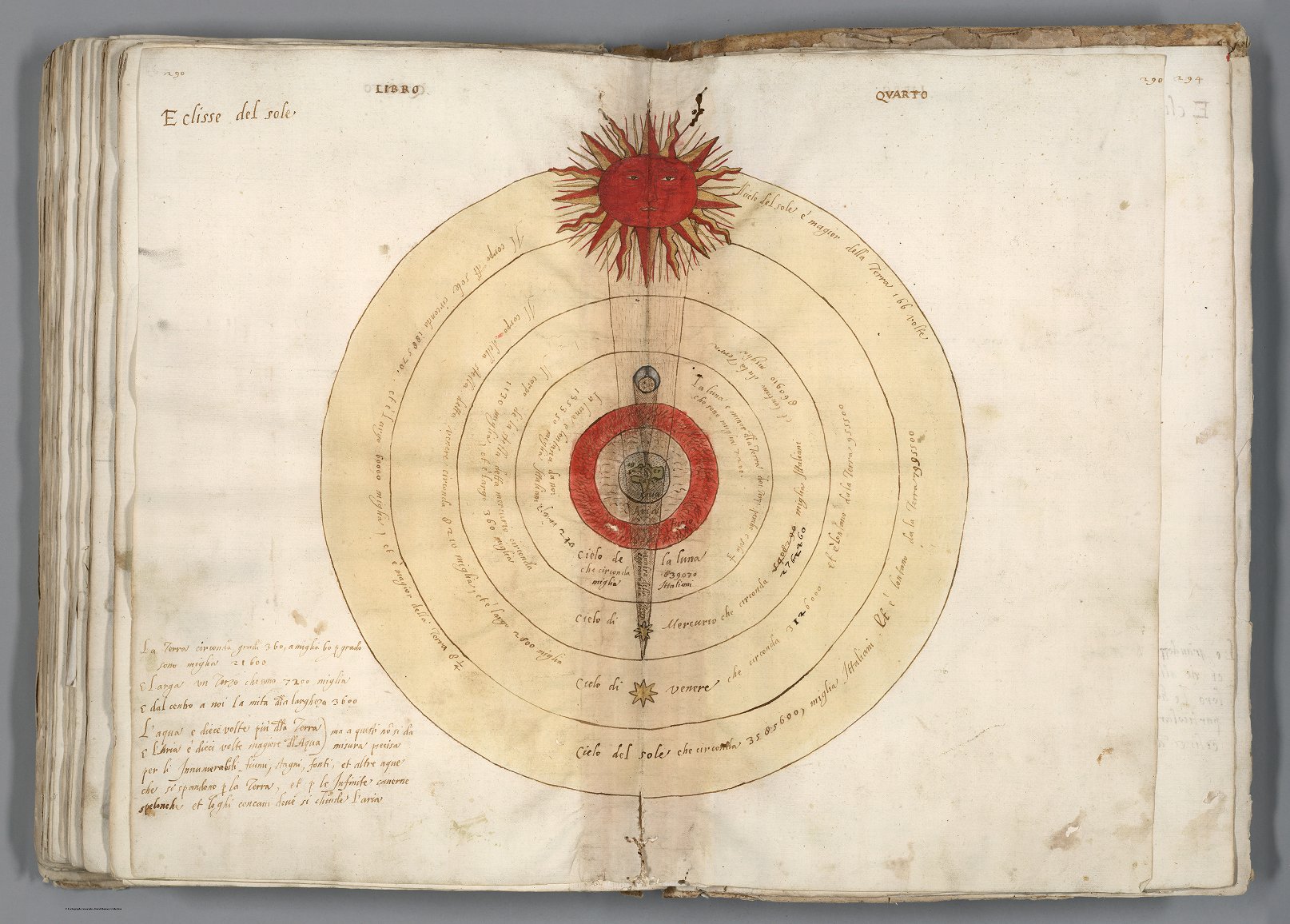
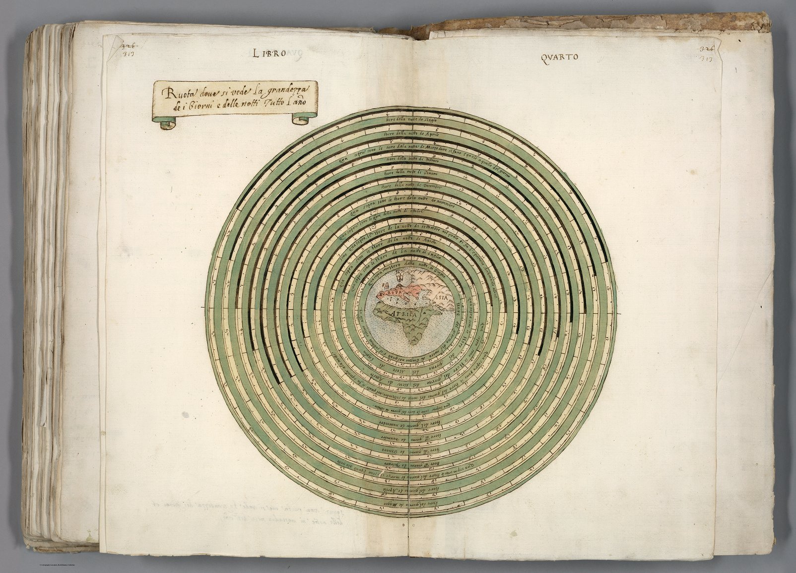
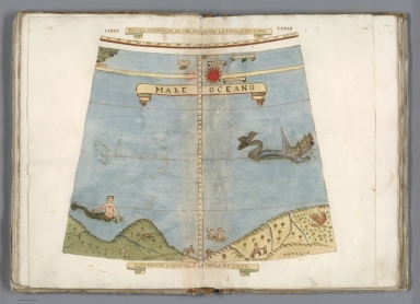
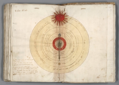
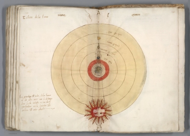
Eclisse del sole (Eclipse of the Sun)
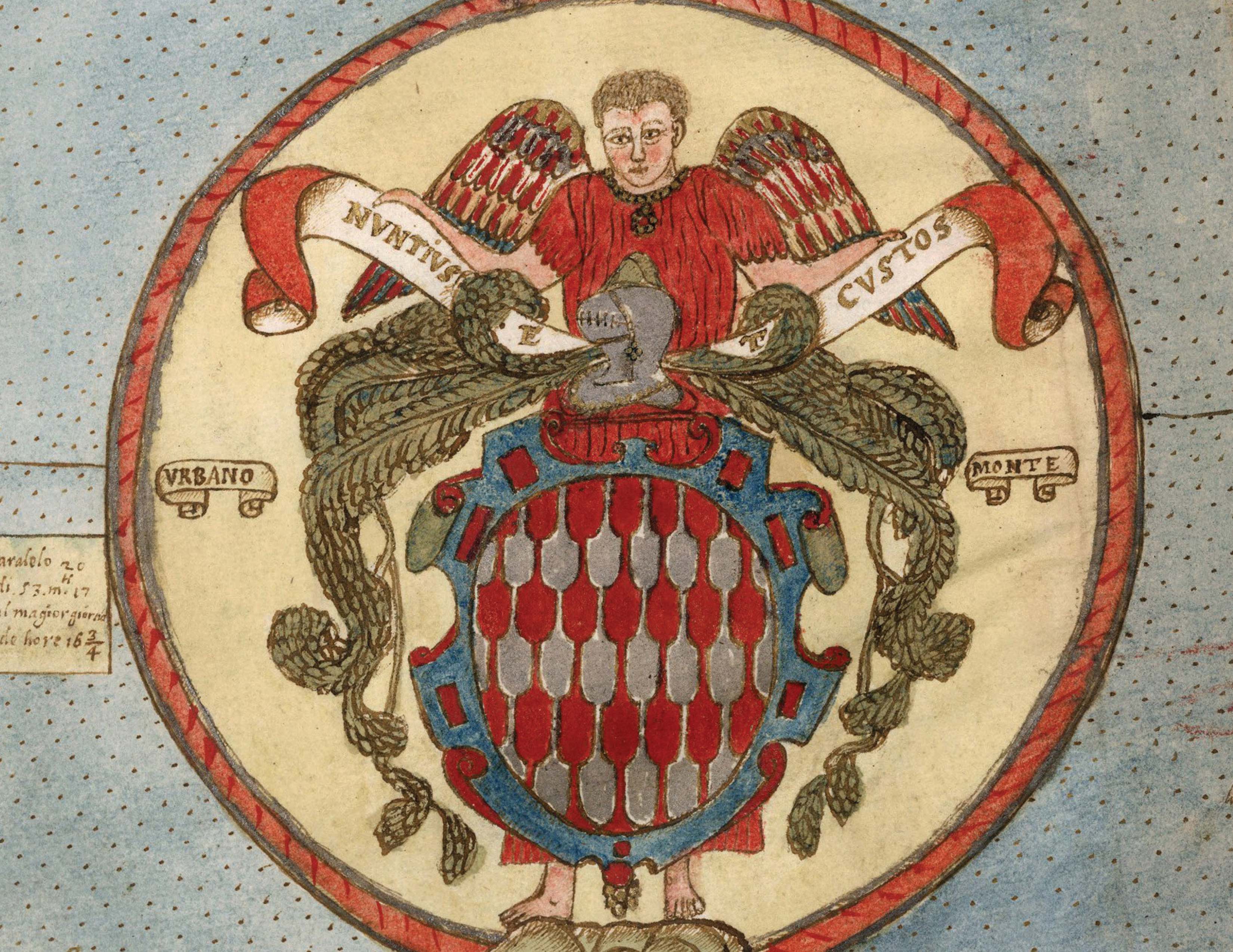
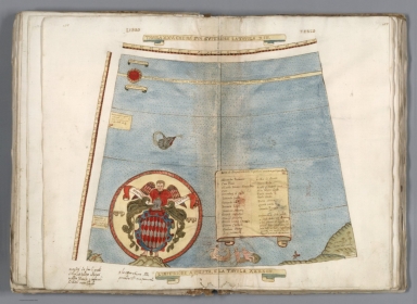
Detail Tavola XXV (Coat of Arms of
Urbano Monte Family)
|
|
|
|
|
|
|
|
|
|
|
|
|
|
|
|
|
|
|
|
|
|
|
|
|
|
|
|
|
|
|
|
|
|
|
|
|
|
|
|
|
|
|
|
|
|
|
|
|
|
|
|
|
|
|
|
|
|
|
|
|
|
|
|
|
|
|
|
|
|
|
|
|
|
|
|
|
|
|
|
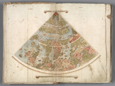
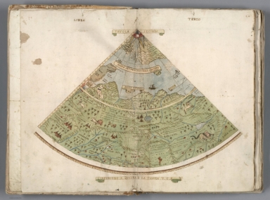
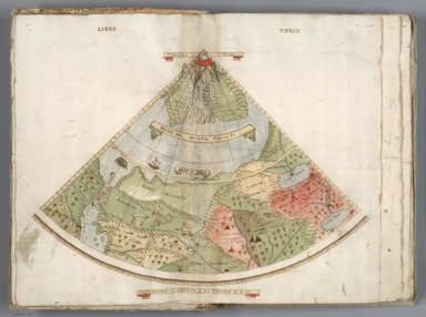
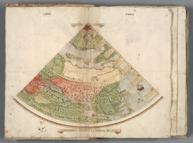
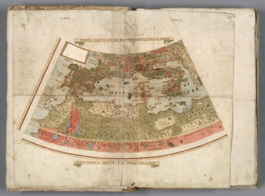
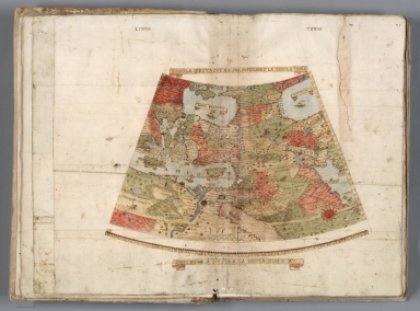


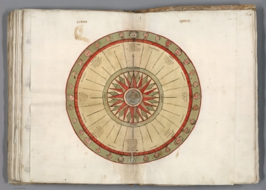
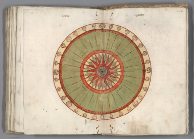
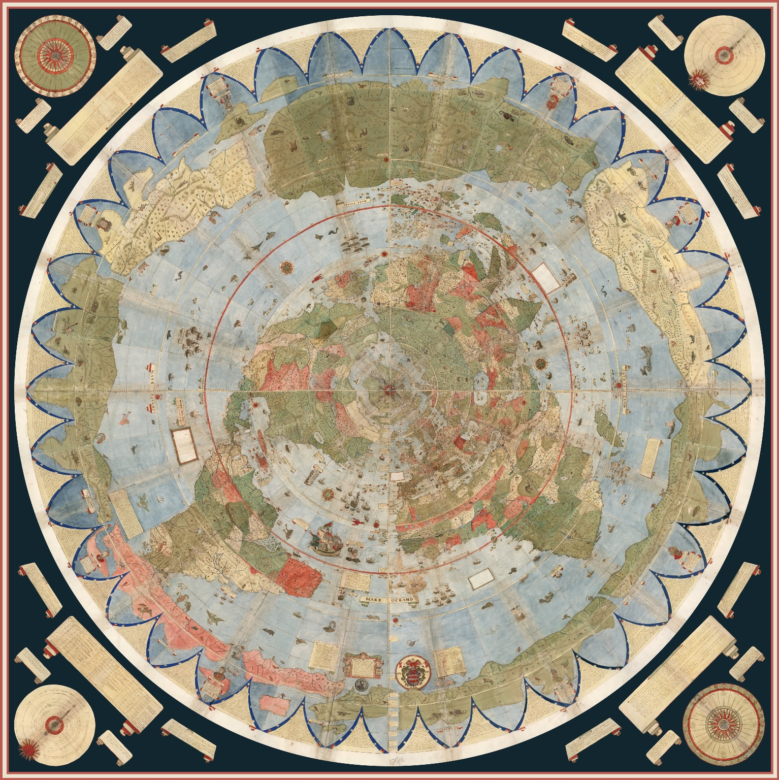
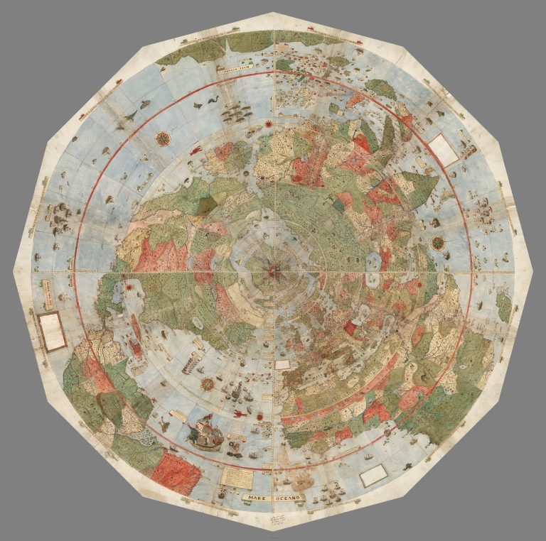
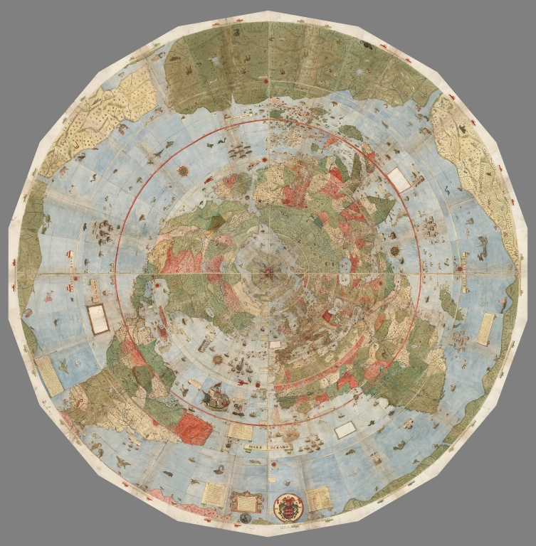
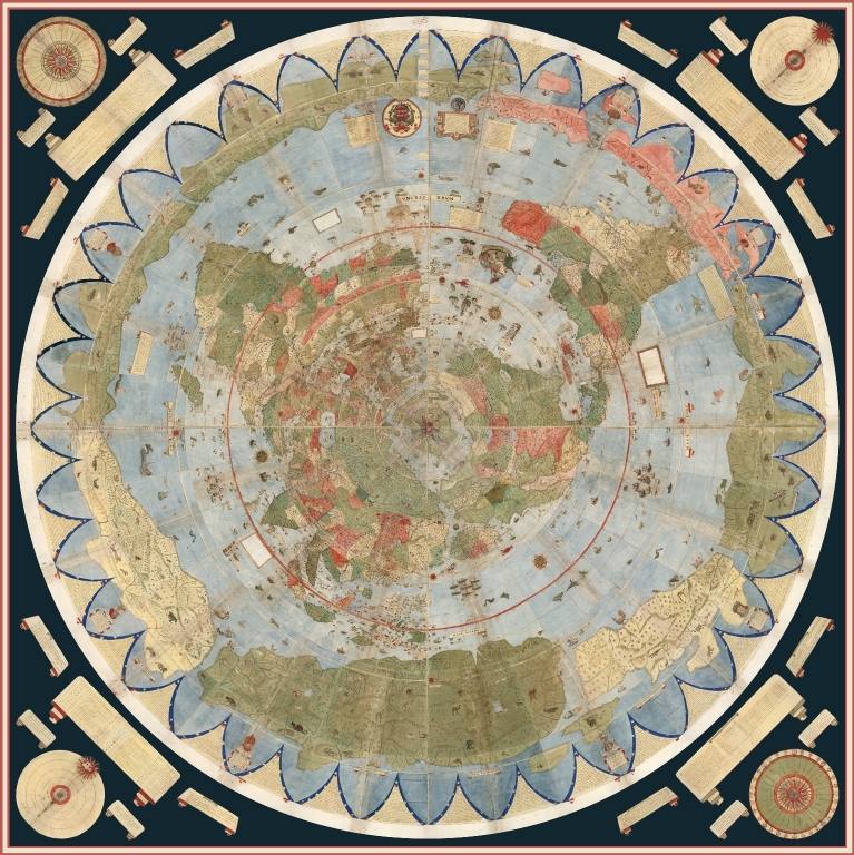
The 6 images below show how the 60 gore sheets and 4 corner
sheets were progressively joined to create the final complete 10 foot
planisphere. The 1st ring of 4 sheets was joined (making sheets 1-4), then the
1st ring was added to the 2nd ring of 8 sheets (making sheets 1-12), then the
1st and 2nd rings were added to the 3rd ring of 12 sheets (making sheets 1-24),
then the 1st, 2nd, and 3rd rings were added to the 4th ring of 18 sheets
(making sheets 1-42), then the 1st through 4th rings were added to the 5th ring
of 18 sheets (making sheets 1-60), and finally those 5 rings were added to the
4 corner sheets and labels making the complete map.
|
Composite of
Tavola 1-4. 1st Ring of Planisphere
|
Composite of Tavola 1-12. 1st
and 2nd Rings of Planisphere
|
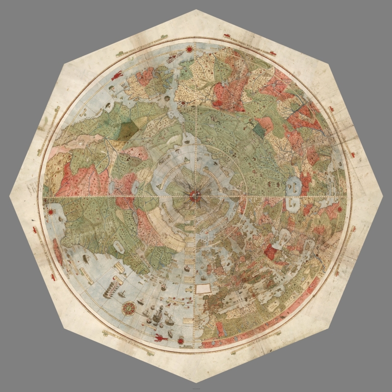
|
Composite of Tavola 1-24. 1st
through 3rd Rings of Planisphere
|
Composite of Tavola 1-42. 1st
through 4th Rings of Planisphere
|
|
Composite of Tavola 1-60. 1st
through 5th Rings of Planisphere
|
Composite of Tavola 1-60 and the
Plates for the 4 Corners
|
When we georeference Monte’s map and then re-project
it into Mercator projection we immediately understand why he used the north
polar projection instead of Mercator’s: Monte wanted to show the entire earth
as close as possible to a three-dimensional sphere using a two-dimensional
surface. His projection does just that, notwithstanding the distortions around
the south pole. Those same distortions exist in the Mercator’s world map, and
by their outsized prominence on Monte’s map they gave him a vast area to
indulge in all the speculations about Antarctica that proliferated in
geographical descriptions in the 16th century. While Mercator’s projection
became standard in years to come due to its ability to accurately measure
distance and bearing, Monte’s polar projection gave a better view of the
relationships of the continents and oceans. In the 20th century air age, the
polar projection returned as a favored way to show the earth. Monte would have
been pleased to see a modern version of his map used in the official emblem of
the United Nations. Below is Monte's map georeferenced and re-projected as
Plate Caree or Geographic. In this form it can be placed in Google Earth.
Monte's Planisphere Georeferenced and Re-projected
in Plate Caree or Geographic
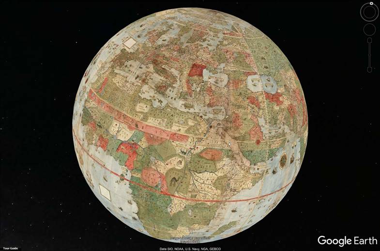
Monte's Re-projected Planishere in
Google Earth - Shown in Video
Click Here to Download KMZ File and Open
in Google Earth - Requires Download of Google Earth Here
Monte's planisphere accompanies a multi volume
geographical treatise on the world and cosmology. It is hoped that further
research will better join the text in the treatise to the text and geographical
descriptions on the map itself. It will be of great interest to discover the
sources of Monte's geographical work and how he configured that information to
create his own unique view of the world in his remarkable map